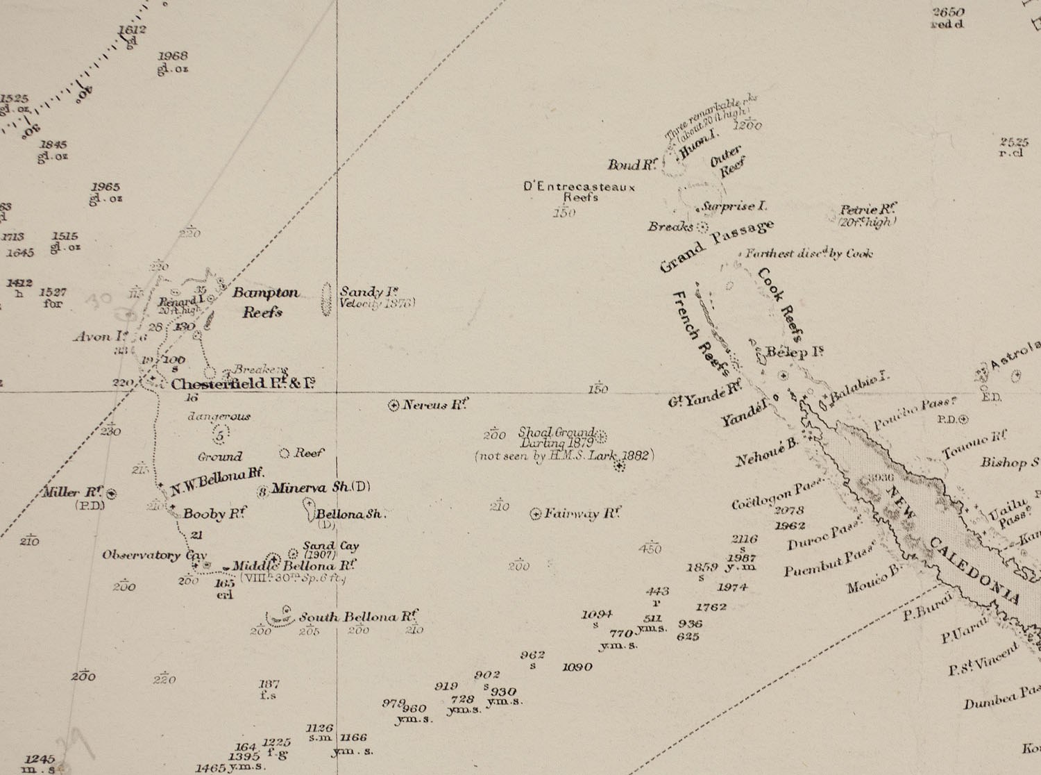

In October 2012 the Australian research ship Southern Surveyor was crossing the eastern Coral Sea on a 25 day scientific voyage when the scientists on board noticed something odd. Their scientific maps, and Google Earth too, showed a long island called Sandy Island lying ahead of them, roughly midway between Australia and the French territory of New Caledonia. The navigation charts used by the ship’s master showed only deep water, and the ship’s route between dredge sites took it close to the spot.
The ship tracked about 5 kilometers south of the charted position, and where the maps placed a strip of land about 25 kilometers long, the crew looked out over open ocean more than a kilometer deep. When the news broke in November, a team of scientists found themselves in headlines around the world for having “undiscovered” an island. The real puzzle came afterward, when researchers began asking how a piece of land that never existed had stayed on the map for well over a century.
What Did the Southern Surveyor Find?
The voyage had nothing to do with phantom islands. According to ABC News, the Southern Surveyor had been tasked with identifying fragments of the Australian continental crust that lie submerged beneath the Coral Sea. Maria Seton of the University of Sydney, who was on board, explained to the AFP news agency why the team wanted a closer look at the spot. “We wanted to check it out because the navigation charts on board the ship showed a water depth of 1,400m in that area,” she said.
What the ship found there was an empty stretch of sea that left the scientists baffled. “It’s on Google Earth and other maps so we went to check and there was no island. We’re really puzzled. It’s quite bizarre,” Seton said after the voyage. She and her colleagues had no explanation to offer at first. “How did it find its way onto the maps? We just don’t know, but we plan to follow up and find out.”
The island was surprisingly well documented for a place that did not exist. ABC News reported that The Times Atlas of the World appeared to show it as Sable Island, and the weather maps used by the Southern Surveyor showed it too. The BBC noted that Australian newspapers had reported that the island would have sat inside French territorial waters, though it did not appear on French government maps. Online, one observer noted that Sandy Island also appeared on Yahoo Maps and Bing Maps “but it disappears up close”.
Where Did Sandy Island Come From?
The trail back to its origin took only days to follow once the story spread around the world. Shaun Higgins, a pictorial librarian at Auckland Museum in New Zealand, searched the museum’s collection of old charts and found Sandy Island on a British Admiralty chart from 1908, and next to it was a note crediting the whaling ship Velocity with the sighting in 1876.
As The Guardian reported, the Velocity’s master returned from a Pacific voyage and reported two unusual features, a series of “heavy breakers” and some “Sandy Islets”. Both found their way into an Australian maritime directory for 1879, which described islets extending north and south “along the meridian 159º 57′ E” and lying between 19 degrees 7 minutes and 19 degrees 20 minutes south. Even then, Higgins said, the captain did not seem entirely convinced, and the islets were regarded as somewhat suspect more than a century ago.
The 1908 chart itself hinted at that doubt about the sighting. “Sandy Island itself, although relatively large, is drawn with a dotted edge [on the 1908 chart], more akin to the way that reefs have been recorded,” Higgins told The Guardian. The chart also carried a general warning that “several details have been collected from the voyages of various navigators extending over a long series of years,” and that some positions might not be exactly right.
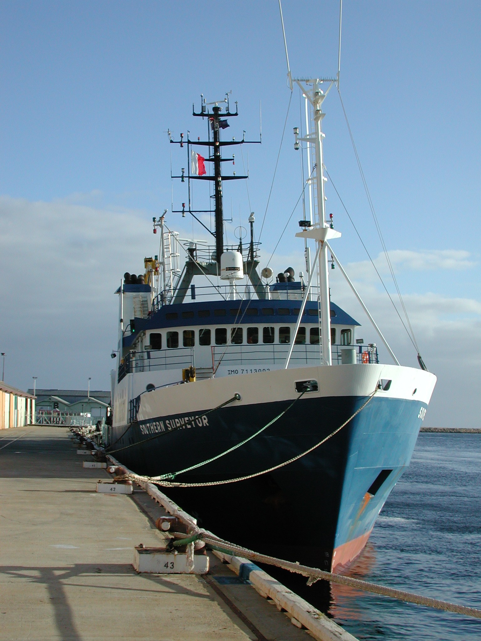

Higgins thought the explanation for the phantom island was probably quite mundane. “My supposition is that they simply recorded a hazard at the time,” he told ABC Radio Australia’s Pacific Beat. “They might have recorded a low-lying reef or thought they saw a reef. They could have been in the wrong place.” The rest, he suggested, was repetition, as the dotted shape was copied from chart to chart, and when asked what was really out there, he laughed and answered, “Nothing!”
The Guardian reported that the identity of the captain who first spotted Sandy Island was not known, and that Lloyd’s Register of Shipping for 1874 and 1875 records five different ships called the Velocity.
How Did a Phantom Island Survive the Satellite Age?
The official charts had in fact caught the error decades earlier, long before anyone sailed out to check. In a 2013 paper in Eos, the magazine of the American Geophysical Union, Seton and three colleagues wrote a mock obituary for the island, and explained that hydrographic charts later placed the abbreviation ED, for existence doubtful, next to it. Seafloor surveys by the Australian Hydrographic Service measured minimum depths of 1,488 to 2,353 meters around and over the supposed island. On that basis the French Hydrographic Service removed it from its official charts in 1974, and the Australian service followed in 1985.
However, the island lived on in the data used by scientists. The Eos authors traced it to the World Vector Shoreline, a global coastline data set created by the US agency now called the National Geospatial-Intelligence Agency as it converted paper charts into digital form. Errors in the original maps, along with mistakes made during digitizing, survived the process. Because many other data sets used that coastline as a mask to separate land from water, the phantom spread. The General Bathymetric Chart of the Oceans and a satellite-derived seafloor model both reported land one meter above sea level at the spot.
Google Earth uses coastlines in a similar way, placing satellite imagery over land and seafloor data over the oceans, and since no satellite photograph showed land there, Sandy Island appeared as an elongated black shape about 25 kilometers long and 5 kilometers wide. The paper describes how the interdependence of these data sets gave errors “wider reign,” so the appearance of the island in several sources was never independent proof that it existed.
The Australian Hydrographic Service suggested to Australian newspapers that the island’s appearance on some maps could simply be human error repeated over the years. According to the BBC, a spokesman said that although some map makers deliberately insert fake streets to catch copyists, the practice would make little sense on nautical charts because it would undermine trust in them. ABC News reported that the service had told Fairfax Media it took the world coastline database “with a pinch of salt.”
What Did the Velocity’s Crew See in 1876?
Once the island was gone, the obvious question became what the whalers of the Velocity had actually seen. Some people suggested online that a real island had since been worn away by the waves. However, the Eos team considered this unlikely, because the measured depths over the site are greater than 1,400 meters and satellite images show no shallow water there. The absence of active volcanoes nearby also rules out a volcanic island that rose and then sank.
The Eos authors allowed that the answer may lie in a simple navigation or transcription error made somewhere between the ship’s deck and the chart maker’s desk. They also raised a more intriguing idea, which is that the crew of the Velocity saw a raft of floating pumice. After an underwater eruption near Tonga in 2001 and 2002, rafts of pumice drifted more than 3,000 kilometers west to the Australian coast, and some passed within 20 kilometers of Sandy Island about 200 days after the eruption. The authors described this route as a “pumice raft superhighway.” In 2012 an eruption of the Havre volcano north of New Zealand produced a raft estimated at 463 kilometers long and 55 kilometers wide, so the authors judged that a raft the size of Sandy Island was a reasonable possibility.
By the time the paper appeared, the island was disappearing from the scientific record. It had been removed from the latest version of the GSHHS coastline database and the newest satellite-derived seafloor model, and Google Earth had deleted the black shape along with its name. The Auckland Museum’s Greg Meylan summed up the strange career of the island in a blog post quoted by The Guardian. “How it managed to appear, disappear and reappear onto various maps and charts is a mystery of the sea.”
Read next: The Mystery of Bermeja: The Mexican Island That Vanished | Hy-Brasil: The Other Atlantis of Irish Legend
In their Eos obituary the scientists wrote that many people were drawn to the story by the idea that world maps, which are taken as baseline truths, may not actually be true. They added that the life and death of Sandy Island “served as an invitation for people to question where information comes from, leading to greater insight into how the world is depicted.” What the crew of the Velocity saw in 1876 has never been established.
Established: No island exists at the charted position of Sandy Island, where measured depths exceed 1,400 meters. The island appears on a 1908 Admiralty chart that credits a sighting by the whaler Velocity in 1876.
Unverified: What the Velocity’s crew actually saw, whether a pumice raft, a reef in the wrong position, or a simple navigation or transcription error.
By Historic Mystery
Sources
- Maria Seton, Simon Williams, Sabin Zahirovic and Steven Micklethwaite, Obituary: Sandy Island (1876 to 2012), Eos, Transactions American Geophysical Union 94(15), April 9, 2013, pp. 141 to 142. doi.org (author copy: earthbyte.org)
- BBC News, South Pacific Sandy Island ‘proven not to exist’, November 22, 2012. bbc.com
- ABC News, Australian scientists un-discover Pacific island, November 22, 2012. abc.net.au
- ABC News, Sandy Island error traced back to 1876 whaling ship, December 3, 2012. abc.net.au
- Luke Harding, Sandy Island: whaling ship behind land that proved not ahoy, The Guardian, November 29, 2012. theguardian.com
- RNZ, Museum tracks mystery of non-existent island, November 26, 2012. rnz.co.nz
