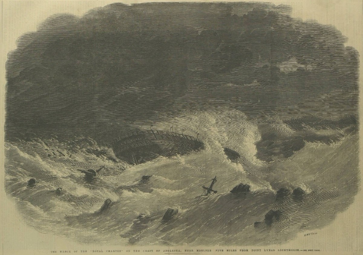

In the autumn of 1859 the Royal Charter was, in the words of the Annual Register, a “well-known vessel” on the run between Liverpool and Australia. She was an iron sailing ship fitted with an auxiliary steam engine, and on her last voyage she had made an unusually quick passage home from Melbourne. On the night of October 25, a few hours from the end of that voyage, she was caught by a violent northerly gale off the north coast of Anglesey.
The wreck has been told many times, often with a great deal of invented drama. The accounts written in 1859 and 1860 are quieter and more useful. They record what the official inquiry found, how the ship was driven ashore, and how a naval officer tried to work out where such a storm had come from.
The Last Night of the Voyage
The Annual Register for 1859 gives the main outline. The ship had left Port Phillip with 498 people aboard and with gold worth, it said, “from 500,000l. to 800,000l.” She passed Queenstown in Ireland on the Monday and Holyhead on the Tuesday evening, under the command of Captain Taylor, whom the Register called “one of the best seamen in the mercantile marine.”
The weather turned as she came along the Welsh coast that evening. According to the inquiry’s narrative, quoted in the Register, the wind at 8 p.m. was “from N.E. to E.N.E., veering and blowing very hard,” and it had been rising since the ship passed Holyhead. The ship was being driven towards the shore, and the lead line showed the water growing shallower.
The Register also said the ship was “unhappily kept near a dangerous lee shore, in the hopes of meeting with a pilot for Liverpool.” No pilot came, and soon after half past ten the crew let go the port anchor, and the starboard anchor followed at 11.15 p.m. For a time the two anchors held her against the wind and the sea.
They did not hold for long, because at 1.30 a.m. on October 26 the port chain parted, and at about 2.30 a.m. the starboard cable went too. The engines had been working at full speed to ease the strain on the chains, but nothing held her now, and at about 3 or 3.30 a.m. she struck the rocks near the village of Moelfre, in a bay that extends from Point Lynas toward Puffin Island.
A Rope to the Shore
The early hours after she struck were not, by the Register’s account, a scene of panic. It reported that “not the slightest alarm was evinced among the passengers, a large portion of whom were women and children,” and that “the most perfect discipline and order prevailed.” The ship had come to rest broadside on, upright, very close to a projecting rock.
It was then that one seaman made the only real chance of rescue. The Register said that “one of the crew, a Portuguese, named Joseph Rogers, nobly volunteered to struggle through the heavy surf, and convey a rope on shore.” The captain gave the order, and the Register reported that “Rogers ably fulfilled his duty.” A stronger hawser was then secured on shore, and a boatswain’s chair was rigged to it.
However, the sea gave the hawser little time to work. A succession of very large waves struck the ship and, in the Register’s words, “absolutely broke her in half amidships.” A few of the crew reached the shore along the hawser. Every officer died, and Captain Taylor was the last man seen alive on board.
The final count was never certain, and the Register stated plainly that “The precise number of persons who perished in this dreadful catastrophe is not ascertained.” Working from the passenger lists, it calculated that 498 people had been aboard at the time of the wreck and that “all but 39 perished,” which gives a figure of about 450.
What the Inquiry Found
The Board of Trade appointed Mr Mansfield, a Liverpool magistrate, and Captain Harris, a nautical assessor, to look into the disaster. Their report found that the Royal Charter was “a well-built and well-found ship,” constructed entirely of iron, with an auxiliary engine and good anchors and cables.
The report did criticise the preparations for bad weather. It noted that the ship had come up the Channel with her lightest masts and yards still aloft, and that there was no evidence to show that the barometers had been consulted. However, it also accepted that the morning had been fine and that there might have been no sign of the hurricane to come.
The Commissioners then gave two conclusions that the Register quoted directly. They said that “all the evidence concurs in showing that the gale was terriffic, and unexampled on that coast,” keeping a spelling that the Register printed as it stood. They added that “The officers and crew to the last were indifferent to the preservation of their own lives, and solely intent upon their duty.”
Charting the Storm
The storm did not only strike Anglesey, and the Register described a tempest across the south and west of England that night, with damage to the breakwater at Portland, the works at Holyhead and the telegraph lines along the coast. Smaller vessels were wrecked in many places, and the total cost in lives went well beyond the Royal Charter.
Rear-Admiral Robert FitzRoy, whose paper describes the observing work of the Meteorological Department of the Board of Trade, set out to reconstruct the storm from observations. In a paper received by the Royal Society in June 1860, he described charts showing “successive phases of the storm on the 25th and 26th of October.” He wrote that this tempest came “from the south-south-west, true,” rather than from the west, and that it was first measured in the Bay of Biscay near Cape Finisterre.
FitzRoy’s charts showed a ring of violent wind around a calmer center. “The wind obtained a varying velocity of from 60 to 100 miles an hour,” he wrote, and it blew from every point of the compass around the lull. At Anglesey the storm came from the north north east, which fits the Register’s account of a northerly gale driving the ship toward the land.
He drew a practical lesson for sailors from the pattern he had found, writing that “Storms from the south-west are followed by sudden and dangerous storms from the north or east, and these are the storms that do most damage on our coasts.” He also noted that the barometer gave less warning with such storms, because it ranges higher when the wind comes from that quarter.
Ships That Never Came Home
The Royal Charter lies among a long list of ships overtaken by the weather on long voyages. Readers of Historic Mysteries will know the case of the Waratah, which “disappeared suddenly on her return voyage from Australia to Cape Town in South Africa” in July 1909.
The Royal Navy suffered a similar fate in 1880. HMS Atalanta was serving as a training ship when she “disappeared with her entire crew in the Bermuda area,” and it was assumed that a powerful storm had sunk her.
The difference is that the Royal Charter left a wreck within sight of land and survivors who could describe her end. The Waratah, as a short video on this site about unsolved shipwreck mysteries puts it, “vanished during a storm in 1909, leaving no wreckage behind.”
What Remains Uncertain
Several details remain open, beginning with the number of people who died, which is an estimate, since the Register itself said the true figure was not ascertained. The amount of gold aboard was given only as a broad range, and the record used here does not settle how much of it was recovered.
The seaman who carried the rope ashore is named in the Register as Joseph Rogers and described as Portuguese. No other record of his name was checked for this article, so he is named here as the Register printed it.
What the records do establish is clear enough. A well-built ship, close to the end of her voyage, met a storm that the official inquiry called unexampled on that coast. The investigation that followed, and FitzRoy’s work on the storm itself, show how seriously the loss was taken at the time.
Sources
- The Annual Register, or a View of the History and Politics of the Year 1859, vol. 101, Chronicle, October 26, pp. 152 to 156. Scan via Internet Archive.
- FitzRoy, Robert. “Notice of ‘The Royal Charter Storm’ in October 1859.” Proceedings of the Royal Society of London 10 (1859 to 1860), pp. 561 to 567. Wikimedia Commons.
- The Wreck of the Royal Charter on the Coast of Anglesea. Engraving by Frederick James Smyth, The Illustrated London News, November 5, 1859. Wikimedia Commons.
