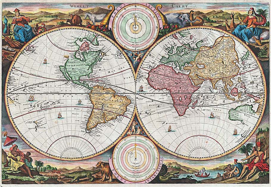
As Woody Guthrie said in his famous song Do Re Mi, “California is a garden of Eden, a paradise to live in or see.” This idea of California as the Garden of Eden or some fantastic terrestrial paradise comes, at least in part, from one of history’s most famous cartographic mistakes.
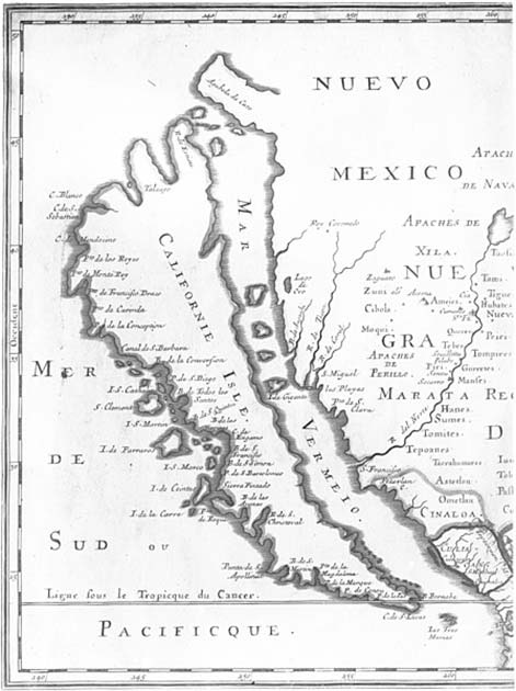
During the 16th century, map makers would often depict California as a large island separated from the mainland of North America by a strait now known as the Gulf of California. Stanford University in Stanford, California, currently holds the world’s most extensive collection of maps of California as an island, with a staggering 800 maps in total!
Why were there so many maps depicting California as an island, and how did this geographic error occur?
The Island of California
One of the first known mentions of the “Island of California” comes from the romance Las sergas de Esplandián by author Garci Rodríguez de Montalvo, published in 1510. In the text, de Montalvo describes the island of California as follows:
“Know, that on the right hand of the Indies there is an island called California very close to the side of the Terrestrial Paradise; and it is peopled by black women, without any man among them, for they live in the manner of Amazons.”

Historians believe that the popularity of Las sergas de Esplandián during the time period in which Europeans began exploring California and the West Coast of North America might have led these explorers to believe that the Baja Peninsula was an island. One fan of Las sergas de Esplandián was Spanish conquistador Hernán Cortés.
Cortés led the first expedition that landed on the southernmost tip of Baja, California, in 1533. Today it is widely known that Baja California is a peninsula; however, when explorers landed there, they believed it was an island.
- Moncacht-Apé: Did this Yazoo Conquer the Wild West First?
- (In Pics) Five Ancient Maps, and What They Can Tell Us
Cortés named this “new island” California after the island with only black women from de Montalvo’s novel. Upon returning to Spain, it was declared that a new island called California had been discovered. In 1539 Hernán Cortés sent a navigator named Francisco de Ulloa to this Island of California but sent him north along both the Pacific and Gulf coasts of Baja.
Ulloa traveled northwards and reached the mouth of the Colorado River at the tip of the Gulf, which suggested that California was not an island but was instead a peninsula. Ulloa described the land he explored as “High and bare, of wretched aspect without any verdure.” European maps were then printed in the 16th century, accurately depicting Baja California as a peninsula.
The incorrect maps that depicted California as an island were circulated not because cartographers all made this same mistake but rather it is due to copying of maps in the early 1600s. Cartographers were known for making copies of maps of other places during this time, raw cartographic research being decidedly more dangerous and expensive than staying at home and reproducing the work of others.
The first map of California as an island was created by Friar Antonio De La Ascension, one of the leaders of the Spanish church, in 1603. While Friar Antonio’s ship was returning to Acapulco, Mexico, they were overtaken by a Dutch pirate ship.
The Dutch pirates found and took Friar Antonio’s map, which depicted California as an island. The pirates took the map believing it to be a major secret Spain was holding from the rest of the world.
Spain was notorious for not saying much about their foreign expeditions, so the Dutch were massively excited to have seized the map. Spain themselves did not publish their map of California until 1802, around 200 years after Friar Antonio explored the area.
Not long after the Dutch stole the Friar’s map, the country began producing maps that depicted California as an island. The Dutch were considered exceptional cartographers, and due to the copying of existing maps, most maps after 1622 showed California as an island.
- The Suspicious Death of Meriwether Lewis (Video)
- Farini’s Great Discovery: Is there a Lost City of the Kalahari?
This led to cartographers from Britain, France, Germany, and Japan all creating maps with the island of California on them. What added to the belief that the state was an island was that sailors who were on Juan de Fuca’s 1592 ship claimed that they had sailed around the island of California.
Juan de Fuca discovered a straight between what is now modern-day Washington State and Vancouver Island. de Fuca was convinced that he had found the legendary Northwest Passage. He was mistaken, but sailors claiming to have sailed around California island were seen as “proof” for the idea that California was, in fact, an island.
What Changed?
While hundreds of maps were created with California depicted as an island, not all maps had this same feature. From the mid-1500s to the end of the 1700s, many maps were made with conflicting geography for California.

One map created by Spain in 1548 has California depicted as a peninsula, while the Dutch maps from 1622 show it as an island, another map from Britain in 1630 also features the island of California, and a French map from 1682 only shows the tip of the Baja Peninsula. It seemed that there was no consensus.
The belief that California was an island finally began to shift thanks to the Jesuit missionary and cartographer Eusebio Francisco Kino. Kino took part in multiple expeditions from the northern area of Sonora (one of the 31 states that comprise the Federal Entities of Mexico).
From Sonora, Kino traveled by land to areas “within or near the Colorado River delta” between 1698 and 1706. While there were still many European explorers who did not believe California was a peninsula, even men who traveled over land with Kino, multiple Jesuit missionaries in Baja, California, including Ferdinand Konščak, Juan de Ugarte, and Wenceslaus Linck, made repeated efforts to end the idea of the island of California once and for all.
It wasn’t until Juan Bautista de Anza’s expeditions between Sonora and the western coast of Alta California from 1774-1776 that the belief of California as an island was officially discounted.
Top Image: The Island of California, 1650. Source: Joan Vinckeboons; Library Of Congress / Public Domain.